System for improving the performance of pilots of aircrafts in aerial photography works and procedure to be used with such system
New avionics system to be used - connected with a flight simulation - to train pilots for aerial works. The same avionics system on-board is useful to improve pilot’s performance and the quality of imagery. Ref: MKT2013/0148_G

Patent Description
New avionics system to be used - connected with a flight simulation - to train pilots for aerial works. The same avionics system on-board is useful to improve pilot’s performance and the quality of imagery. Partners to further develop the system and/or to establish commercial agreements along with technical cooperation are sought.
The Challenge
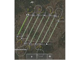
Aerial imagery works consist on a photographic system onboard an aircraft, in nadir orientation, shooting at regular intervals to obtain pictures of the Earth from above. The set of images are useful to observe a piece of Earth under interest. In order to obtain a quality imagery, it is very important that the aircraft to flies very stable in altitude, attitude and velocity. The subsequent parallel tracks required to scan a given area must keep accurate parallel headings. Current training of pilots in flying accurate tracks is based in the use of flight instruments which work with radio navigation signals, such as lnstrument Landing Systems (ILS). But for aerial imagery works these radio signals are not available. The expertise of the pilot for aerial imagery works needs new training tools and new onboard instruments to avoid bad quality outcomes, or to save the cost of repeating parts of the flight.
The Technology
This invention consists in a flight instrument and its related avionics system to be used on ground connected with a flight simulator, and also to be boarded into an aircraft. The flight instrument is a display, with the look and feel of a Course Deviation Indicator (CDI), commonly found in flight instruments like ILS. The CDI shows the current deviation of the aircraft from the target path, both in altitude and in lateral distance. The measures of deviation of the flight are computed by the avionics system in connection with a secondary positioning system or with the flight simulator data. The technology includes the specification of flight profiles for aerial imagery works.
Innovative advantages
- Pilots’ training tool for aerial imagery works
- A new flight instrument to improve quality of remote images
- Special attention to difficult turning maneuvers
- Reduction of flight hours and the related cost
- Acoustic and colored alarms
- Retrieves a final score for training evaluation
Current stage of development
The system is fully developed in combination with one commercial flight simulator and is being tested by professional pilots from AirMed Group.
Applications and Target Market
- Flight simulation software companies
- Certification industry for aircraft components
- Aircraft operators involved in aerial imagery works

Ease and costless training for aircraft pilots involved in aerial works.
Display indicator very familiar and well known for pilots with IFR license.

Improve the efficiency of your aerial fleet flight hours.
Business Opportunity
Technology available for licensing with technical cooperation
Patent Status
Priority application.
Contact
Sonia Touriño Eirin
Licensing Manager
T. + 34 93 413 623
Sonia.tourino@upc.edu.
Comparteix: